brighton BN14 Postcodes
Spending a fortune on conveyancing?

Compare instant, low-cost online quotes from trusted conveyancing solicitors.
Backed by experts, our no-obligation service searches through the best conveyancing quotes on the market to save you time and money.
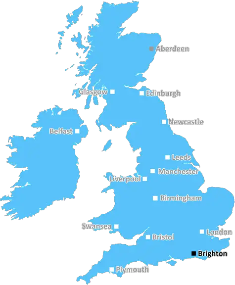
Brighton (BN14)
The BN14 postcode area is located in the Brighton postcode town region, within the county of West Sussex, and contains a total of 1020 individual postcodes.
There are 12 electoral wards in the BN14 postcode area, including Arundel, Brighton, Eastbourne, Hailsham, Hassocks, Henfield, Hove, Lancing, Lewes, Littlehampton, Newhaven, Peacehaven, Pevensey, Polegate, Seaford, Shoreham-By-Sea, Steyning, Worthing which come under the local authority of the Worthing Council.
Combining the whole postcode region, 24% of people in BN14 are classed as having an AB social grade, (i.e. 'white-collar' middle-upper class), compared to 27% across the UK.
This does not mean that the people of BN14 are poorer than other areas, but it may give an indication that there are areas of deprivation.
The BN14 postcode covers an area which falls mainly within the borough of Worthing in West Sussex. The area includes parts of Worthing, Lancing and Sompting, including the South Downs National Park. It is approximately 8 miles from Brighton city centre.
BN14 has a range of friendly, diverse neighbourhoods and quaint villages, as well as beautiful stretches of coastline and the rolling South Downs countryside, all of which make for a peaceful day out. The area is home to a range of different attractions, which include historic houses and museums, shopping districts, parks and gardens, and nature reserves.
The area is well connected to the rest of the region and the country, with two main railway lines and a number of local bus links. In recent years, the area has seen significant investment, particularly in terms of its transport infrastructure, which has included the construction of a new railway station at Lancing.
BN14 also has a selection of sporting and leisure activities available ranging from golf courses and leisure centres, to outdoor activities such as sailing, cycling, fishing, and walking, as well as plenty of pubs and bars.
The local economy is largely based on retail, hospitality and leisure, as well as educational and public service sectors. There are also a growing number of technology companies based in the BN14 postcode. The area also benefits from a number of employment opportunities, particularly in the tourism and hospitality sectors.
The BN14 area is also well known for its independent businesses, which include a wide range of cafes, restaurants, pubs, and independent retailers. There is an annual Worthing Festival, which attracts large crowds from across the region, and a range of events throughout the year.
The postcode is served by two secondary schools, Worthing High School and Lancing College and five primary schools. The area is also home to numerous healthcare providers, including GP practices, dentists, opticians, and pharmacists, as well as several hospitals and care homes. The area also includes a range of housing options from large detached family homes, to flats and bungalows, providing housing to suit different needs and budgets.

Demographics
West Sussex

BN14 is located in the county of West Sussex, in England.
West Sussex has a total population of 843,800, making it the 28th largest county in the UK.
West Sussex has a total area of 770 square miles, and a population density of 423 people per square kilometre. For comparison, Greater London has a density of 5,618 people/km2.
| Outward Code | BN14 |
| Postal Town | Brighton |
| MSOA Name | Worthing 001 |
| LSOA Name | Worthing 001C |
| County | West Sussex |
| Region | West Sussex |
| Country | England |
| Local Authority | Worthing |
| Area Classification | Urban with City and Town |
BN14 Electoral Wards
The postal region of BN14, includes the local towns, villages, electoral wards and stations of:
Dig even deeper into the BN14 postcode by clicking on a postcode below:
Click on an outward postal code below for more information about the area. Each 'outward' postcode give you a comprehensive list of all postcodes within the outward code area (BN) and estimated address.
Click on an 'outward' code for more information. For example, the outward postcode page 'EC2M' will give you an alphabetical list covering all postcodes located in the region, from 'EC2M 1BB' through to 'EC2M 7YA'.
Chris H
Wednesday, April 17, 2024
We don't have any views of BN14 right now. If you live in BN14 or have visited it, please help us to help others by telling others what you think of this neighbourhood.
Add your view of BN14
People need your local expertise. If you live in BN14 or have first-hand knowledge of the neighbourhood, please consider sharing your views. It's completely anonymous - all we ask is for your initials.
Please tell us what you like about the BN14 postcode area, what you don't like, and what it's like to live or work here.
| LOCAL AMENITIES | |
| FAMILY FRIENDLY | |
| PARKING | |
| GREEN SPACES |
Local News Sussex
Leicestershire and Sussex settle for rain-hit draw
Not a single ball is bowled on the final day because of rain as Leicestershire and Sussex draw in the County Championship.
BBC NewsCouncil to restore heritage Sussex rail bridge
East Sussex County Council says engineers will inspect the Church Road Bridge ahead of restoration.
BBC NewsSussex social worker charged with sex offences
An investigation was launched by Sussex Police after "sexual messages" were found.
BBC NewsHardest Geezer reveals next challenge after Africa run
Russell Cook, nicknamed Hardest Geezer, crossed the finish line in Tunisia after 352 days.
BBC NewsMuric own goal 'not his fault' as Burnley denied win
A calamitous own goal by goalkeeper Arijanet Muric prevents Burnley from securing a vital Premier League win over Brighton at Turf Moor.
BBC NewsResidents prepare to cast votes in local elections
Over 50 seats are up for re-election in four local councils across East and West Sussex in May.
BBC NewsSussex's Simpson hits 205 to stun Leicestershire
John Simpson hits a maiden double century as Sussex put Leicestershire to the sword on day three.
BBC NewsFamily of dead Albanian migrant want answers
Alfred Dosku died in hospital in Redhill in 2023 after he was found by immigration centre staff.
BBC NewsFrom the Postcode Area blog

Deciphering Crime Rates - a Deep Dive Into UK Postcode Analysis
Ever wondered about the crime rate in your UK postcode? You're not alone. We've dug deep into the data, uncovering trends and patterns that'll make your head spin.

Death of the High Street?
The BBC reports that despite councils' attempts to kurb them, the UK's high streets have seen a huge growth in fast food outlets. Could this mark the death knell for the Great British high street, and what can we do about it to halt its decline?

Discrimination by Postcode
You really couldn't make it up, could you? Some of the country's most vulnerable people are missing out on their weekly £25 Cold Weather Payment, just because the system that's in operation is discriminating against them because payments are based on postcode, rather than geographic location.

The Redesign is Underway
Well, the current website was absolutely in dire need of a good redesign - from the ground up. So I set out to pull it all apart and get it up and running again to become the most comprehensive guide to every postcode in the UK. And it's been a long, tough job from start to finish - and quite possibly the biggest project I've ever undertaken.
SOCIAL GRADES
According to census records, 24% of people here have a social grade of AB (highest), compared to the national average of 27%.