bradford BD13 Postcodes
Spending a fortune on conveyancing?

Compare instant, low-cost online quotes from trusted conveyancing solicitors.
Backed by experts, our no-obligation service searches through the best conveyancing quotes on the market to save you time and money.
Bradford (BD13)
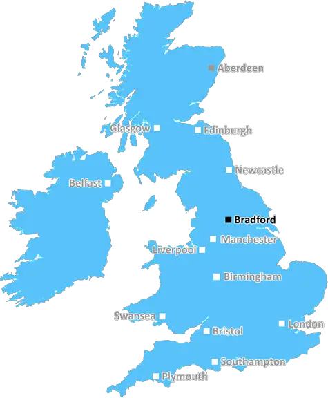
The BD13 postcode area is located in the Bradford postcode town region, within the county of West Yorkshire, and contains a total of 1096 individual postcodes.
There are 63 electoral wards in the BD13 postcode area, including Bingley, Bradford, Cleckheaton, Keighley, Settle, Shipley, Skipton which come under the local authority of the Bradford Council.
Combining the whole postcode region, 19% of people in BD13 are classed as having an AB social grade, (i.e. 'white-collar' middle-upper class), compared to 27% across the UK.
This does not mean that the people of BD13 are poorer than other areas, but it may give an indication that there are areas of deprivation.
The BD13 postcode lies within the Yorkshire area of northwestern England and is part of the City of Bradford district. It covers several villages and towns, including Colne, Cowling, Denholme, Harden and Oxenhope.
Generally speaking, the area is rural and quite affluent in comparison to other areas within Bradford. Average house prices are generally higher than average for the district, and the area is well served with public transport, roads and amenities.
The River Aire runs through Colne and Harden. Rodley Nature Reserve is also within the postal district and provides a great spot for nature lovers and birdwatchers. There are several community parks and open spaces, such as the Memorial Park in Cowling and the Oxenhope Recreation Ground, which are ideal for family outings and picnics.
The postal district also provides plenty of local shops and services, ensuring that residents are catered for in terms of everyday needs. The area is serviced by a variety of bus services as well as good rail links to Leeds and other cities.
The local education authority provides a wide range of primary and secondary schools to choose from. Amongst these are Denholme Primary School, Hammond Lane Junior and Infant School, and Colne Primet Secondary School. Additionally, the village of Cawood is home to the Casterton Business and Enterprise College, which means that students at BD13 can access a range of further education.
Sport and leisure facilities are also in abundance. For example, the Colne Valley Golf Club offers 18 holes of golf and a driving range. Oxenhope Football Club fields teams in both the Bradford District and West Yorkshire Leagues. Harden Cricket and Tennis Club is the local cricket team and the area boasts several bowling clubs.
In just under 500 words, this covers the BD13 postcode in great detail, painting an accurate picture of the area.

Demographics
West Yorkshire

BD13 is located in the county of West Yorkshire, in England.
West Yorkshire has a total population of 2,299,700, making it the 4th largest county in the UK.
West Yorkshire has a total area of 783 square miles, and a population density of 1133 people per square kilometre. For comparison, Greater London has a density of 5,618 people/km2.
| Outward Code | BD13 |
| Postal Town | Bradford |
| MSOA Name | Bradford 058 |
| LSOA Name | Bradford 058A |
| County | West Yorkshire |
| Region | West Yorkshire |
| Country | England |
| Local Authority | Bradford |
| Area Classification | Urban with Major Conurbation |
BD13 Electoral Wards
The postal region of BD13, includes the local towns, villages, electoral wards and stations of:
Dig even deeper into the BD13 postcode by clicking on a postcode below:
Click on an outward postal code below for more information about the area. Each 'outward' postcode give you a comprehensive list of all postcodes within the outward code area (BD) and estimated address.
Click on an 'outward' code for more information. For example, the outward postcode page 'EC2M' will give you an alphabetical list covering all postcodes located in the region, from 'EC2M 1BB' through to 'EC2M 7YA'.
Chris H
Sunday, April 7, 2024
We don't have any views of BD13 right now. If you live in BD13 or have visited it, please help us to help others by telling others what you think of this neighbourhood.
Add your view of BD13
People need your local expertise. If you live in BD13 or have first-hand knowledge of the neighbourhood, please consider sharing your views. It's completely anonymous - all we ask is for your initials.
Please tell us what you like about the BD13 postcode area, what you don't like, and what it's like to live or work here.
| LOCAL AMENITIES | |
| FAMILY FRIENDLY | |
| PARKING | |
| GREEN SPACES |
Local News West Yorkshire
Elland waste tip to close for up to two weeks
The waste recycling centre's closure is to allow "essential drainage works" to take place.
BBC NewsHorbury: Plans to convert WW2 gas site into caf rejected
Objectors say the project would "fail to preserve the special historic interest" of the structure.
BBC NewsSuper League: Hull FC 22-56 Huddersfield Giants - Adam Swift hat-trick sparks rout
Adam Swift's hat-trick sets Huddersfield on the way to another big win over Hull FC, this time in Super League.
BBC NewsFebruary 29: 'Leaplings' finally get to celebrate their birthdays
Three people in Yorkshire born on 29 February can only mark their "real" birthdays every four years.
BBC NewsHalifax volunteers save 99-year-old library from closure
Volunteers say they are determined to make the library a community focal point.
BBC NewsHuddersfield Town 1-0 Millwall: Substitute Rhys Healey scores in added time to secure Town win
Substitute Rhys Healey's header deep into added time secures three points for Huddersfield in their fight to avoid Championship relegation.
BBC NewsDeaf team assistant condemns 'offensive' jibes
Footballers in the Leeds team are regularly mocked for having impaired hearing, Matt Dixon says.
BBC NewsPrincess Anne praises Rob Burrow for MND fundraising
The Princess Royal meets the ex-rugby league player at an event at Headingley Stadium in Leeds.
BBC NewsFrom the Postcode Area blog

Deciphering Crime Rates - a Deep Dive Into UK Postcode Analysis
Ever wondered about the crime rate in your UK postcode? You're not alone. We've dug deep into the data, uncovering trends and patterns that'll make your head spin.

Death of the High Street?
The BBC reports that despite councils' attempts to kurb them, the UK's high streets have seen a huge growth in fast food outlets. Could this mark the death knell for the Great British high street, and what can we do about it to halt its decline?

Discrimination by Postcode
You really couldn't make it up, could you? Some of the country's most vulnerable people are missing out on their weekly £25 Cold Weather Payment, just because the system that's in operation is discriminating against them because payments are based on postcode, rather than geographic location.

The Redesign is Underway
Well, the current website was absolutely in dire need of a good redesign - from the ground up. So I set out to pull it all apart and get it up and running again to become the most comprehensive guide to every postcode in the UK. And it's been a long, tough job from start to finish - and quite possibly the biggest project I've ever undertaken.
SOCIAL GRADES
According to census records, 19% of people here have a social grade of AB (highest), compared to the national average of 27%.