peterborough PE10 Postcodes
Spending a fortune on conveyancing?

Compare instant, low-cost online quotes from trusted conveyancing solicitors.
Backed by experts, our no-obligation service searches through the best conveyancing quotes on the market to save you time and money.
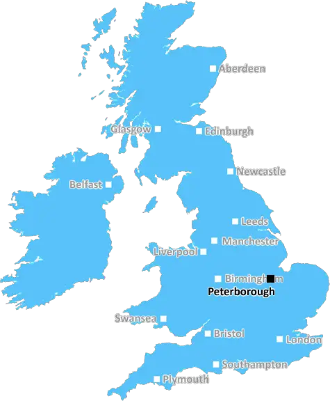
Peterborough (PE10)
The PE10 postcode area is located in the Peterborough postcode town region, within the county of Lincolnshire, and contains a total of 791 individual postcodes.
There are 34 electoral wards in the PE10 postcode area, including Boston, Bourne, Chatteris, Downham Market, Hunstanton, Huntingdon, King's Lynn, March, Peterborough, Sandringham, Skegness, Spalding, Spilsby, St Ives, St Neots, Stamford, Swaffham, Wisbech which come under the local authority of the South Kesteven Council.
Combining the whole postcode region, 25% of people in PE10 are classed as having an AB social grade, (i.e. 'white-collar' middle-upper class), compared to 27% across the UK.
This does not mean that the people of PE10 are poorer than other areas, but it may give an indication that there are areas of deprivation.
The PE10 postcode covers the High Ferry to Wilsford area in the Peterborough district of East Anglia in the United Kingdom. The area is part of the historic county of Lincolnshire and the postcode district covers an approximate 16.88 square miles. It includes the villages of Bourne, Langtoft and Lound, as well as smaller hamlets such as Amcotts, Corby Glen and Toft.
The PE10 postcode is bounded by the PE12 postcode to the west, the NG34 postcode to the east and the PE11 postcode to the south. According to the latest census, the population of the postcode area stands at a little over 14,000.
The local economy is mainly driven by farming and tourism, while the larger local settlements serve as local service centres for the surrounding villages. Protected nature reserves at Langtoft Fen and Thurlby Common provide a peaceful contrast to the hustle and bustle of life in the larger towns of Stamford and Peterborough.
With a range of transport options, the area is well-connected to the rest of the East Anglian region. Regular bus services connect Bourne and the surrounding villages to the larger post towns of Bourne, Stamford, Spalding, Grantham and Peterborough. Raillinks and good road links make it easy to get around the region.
There are a range of local amenities and services available. Primary schools in the area include Tattershall C of E Primary School and Glebe Primary School, while secondary schools are provided by the Deepings School in Market Deeping or Bourne Academy in Bourne. Peterborough City Council and South Kesteven District Council provide local government services, and for leisure and recreation, there are several parks, recreation grounds and public open spaces, as well as regional attractions such as the suburban RAF Wittering.

Demographics

Lincolnshire

PE10 is located in the county of Lincolnshire, in England.
Lincolnshire has a total population of 1,073,300, making it the 18th largest county in the UK.
Lincolnshire has a total area of 2693 square miles, and a population density of 153 people per square kilometre. For comparison, Greater London has a density of 5,618 people/km2.
| Outward Code | PE10 |
| Postal Town | Peterborough |
| MSOA Name | South Kesteven 010 |
| LSOA Name | South Kesteven 010B |
| County | Lincolnshire |
| Region | Lincolnshire |
| Country | England |
| Local Authority | South Kesteven |
| Area Classification | Largely Rural (rural including hub towns 50-79%) |
PE10 Electoral Wards
The postal region of PE10, includes the local towns, villages, electoral wards and stations of:
Dig even deeper into the PE10 postcode by clicking on a postcode below:
Click on an outward postal code below for more information about the area. Each 'outward' postcode give you a comprehensive list of all postcodes within the outward code area (PE) and estimated address.
Click on an 'outward' code for more information. For example, the outward postcode page 'EC2M' will give you an alphabetical list covering all postcodes located in the region, from 'EC2M 1BB' through to 'EC2M 7YA'.
Chris H
Monday, April 8, 2024
We don't have any views of PE10 right now. If you live in PE10 or have visited it, please help us to help others by telling others what you think of this neighbourhood.
Add your view of PE10
People need your local expertise. If you live in PE10 or have first-hand knowledge of the neighbourhood, please consider sharing your views. It's completely anonymous - all we ask is for your initials.
Please tell us what you like about the PE10 postcode area, what you don't like, and what it's like to live or work here.
| LOCAL AMENITIES | |
| FAMILY FRIENDLY | |
| PARKING | |
| GREEN SPACES |
Local News Lincolnshire
Dinosaur trail organisers slam 'mindless' vandals
Officials say CCTV footage is being studied and Lincolnshire Police are investigating
BBC NewsCarlisle United 1-3 Lincoln City
Lincoln continue their late play-off charge with a 3-1 victory over relegation-threatened Carlisle.
BBC NewsMore money needed to restore city's 'Wonky House'
The 16th Century buildings near the city's cathedral are undergoing a 450,000 restoration.
BBC NewsFour men to appear at Lincoln Crown Court charged with GBH after alleged assault left man in hospital
A man was taken to hospital to receive medical treatment after the alleged assault
Lincolnshire LiveHickory's Smokehouse South Hykeham opening date confirmed with bookings available
Customers can book a table at Hickory's ahead of opening
Lincolnshire LiveBus services double in Skegness with more routes and areas covered
Stagecoach and the council has made improvements to some of its services
Lincolnshire LiveMan charged with attempted murder after assault
Police say a man was seriously injured in the assault on Friday.
BBC NewsMan charged with attempted murder of woman
The alleged victim was left with life-threatening injuries and remains in a critical condition.
BBC NewsFrom the Postcode Area blog

Deciphering Crime Rates - a Deep Dive Into UK Postcode Analysis
Ever wondered about the crime rate in your UK postcode? You're not alone. We've dug deep into the data, uncovering trends and patterns that'll make your head spin.

Death of the High Street?
The BBC reports that despite councils' attempts to kurb them, the UK's high streets have seen a huge growth in fast food outlets. Could this mark the death knell for the Great British high street, and what can we do about it to halt its decline?

Discrimination by Postcode
You really couldn't make it up, could you? Some of the country's most vulnerable people are missing out on their weekly £25 Cold Weather Payment, just because the system that's in operation is discriminating against them because payments are based on postcode, rather than geographic location.

The Redesign is Underway
Well, the current website was absolutely in dire need of a good redesign - from the ground up. So I set out to pull it all apart and get it up and running again to become the most comprehensive guide to every postcode in the UK. And it's been a long, tough job from start to finish - and quite possibly the biggest project I've ever undertaken.
SOCIAL GRADES
According to census records, 25% of people here have a social grade of AB (highest), compared to the national average of 27%.