peterborough PE20 Postcodes
Spending a fortune on conveyancing?

Compare instant, low-cost online quotes from trusted conveyancing solicitors.
Backed by experts, our no-obligation service searches through the best conveyancing quotes on the market to save you time and money.
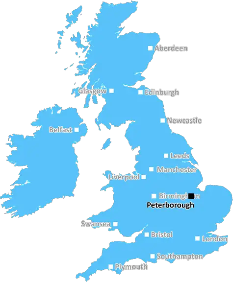
Peterborough (PE20)
The PE20 postcode area is located in the Peterborough postcode town region, within the county of Lincolnshire, and contains a total of 667 individual postcodes.
There are 74 electoral wards in the PE20 postcode area, including Boston, Bourne, Chatteris, Downham Market, Hunstanton, Huntingdon, King's Lynn, March, Peterborough, Sandringham, Skegness, Spalding, Spilsby, St Ives, St Neots, Stamford, Swaffham, Wisbech which come under the local authority of the Boston Council.
Combining the whole postcode region, 15% of people in PE20 are classed as having an AB social grade, (i.e. 'white-collar' middle-upper class), compared to 27% across the UK.
This does not mean that the people of PE20 are poorer than other areas, but it may give an indication that there are areas of deprivation.
PE20 is a postcode in the East of England, covering part of the Peterborough district in Lincolnshire. It covers several small towns and villages including Folkingham, Langtoft, Rippingale, King Street, Dyke, Fotherby, Burghley and Londonthorpe.
The area is primarily rural, known for its open spaces, extensive farmland, and historic heritage. The majority of homes are detached, with only a small percentage of terraced housing. Homes are on average cheaper than those in neighbouring towns and villages.
PE20 has two primary schools; Folkingham Primary Academy and Langtoft Primary Academy, a pre-school and nursery, and a large number of local private and independent schools in neighbouring towns. There are many sports clubs, arts groups and seasonal events taking place in PE20, as well as a good selection of pubs, restaurants and shops.
The area is situated next to the A1 motorway, providing quick access to major cities like London and Cambridge. It is also close to Stamford and Grantham, with a direct train service from Peterborough to London Kings Cross.
PE20 is well connected to the rest of the Peterborough area, with regular bus services, and good road networks. It is within close proximity to Bourne Wood � an area of outstanding natural beauty � and is within easy reach of the coast. The postcode is popular for cycling, walking and horse riding.
PE20 provides access to the popular tourist destination of LincsLife, which has a diverse range of attractions, events, places to eat and drink, and activities for all ages. Further activities include bird watching, angling, golf courses, historic monuments, and many more.

Demographics

Lincolnshire

PE20 is located in the county of Lincolnshire, in England.
Lincolnshire has a total population of 1,073,300, making it the 18th largest county in the UK.
Lincolnshire has a total area of 2693 square miles, and a population density of 153 people per square kilometre. For comparison, Greater London has a density of 5,618 people/km2.
| Outward Code | PE20 |
| Postal Town | Peterborough |
| MSOA Name | Boston 007 |
| LSOA Name | Boston 007B |
| County | Lincolnshire |
| Region | Lincolnshire |
| Country | England |
| Local Authority | Boston |
| Area Classification | Urban with Significant Rural (rural including hub towns 26-49%) |
PE20 Electoral Wards
The postal region of PE20, includes the local towns, villages, electoral wards and stations of:
Dig even deeper into the PE20 postcode by clicking on a postcode below:
Click on an outward postal code below for more information about the area. Each 'outward' postcode give you a comprehensive list of all postcodes within the outward code area (PE) and estimated address.
Click on an 'outward' code for more information. For example, the outward postcode page 'EC2M' will give you an alphabetical list covering all postcodes located in the region, from 'EC2M 1BB' through to 'EC2M 7YA'.
Chris H
Monday, April 8, 2024
We don't have any views of PE20 right now. If you live in PE20 or have visited it, please help us to help others by telling others what you think of this neighbourhood.
Add your view of PE20
People need your local expertise. If you live in PE20 or have first-hand knowledge of the neighbourhood, please consider sharing your views. It's completely anonymous - all we ask is for your initials.
Please tell us what you like about the PE20 postcode area, what you don't like, and what it's like to live or work here.
| LOCAL AMENITIES | |
| FAMILY FRIENDLY | |
| PARKING | |
| GREEN SPACES |
Local News Lincolnshire
Tools worth thousands taken in van break-ins
Some of the vans had holes in them, say Lincolnshire Police.
BBC NewsMan charged with attempted murder after assault
Police say a man was seriously injured in the assault on Friday.
BBC NewsMan, 24, dies after crash involving motorbike and Mini near Market Deeping
Police are appealing for information
Lincolnshire LiveFirst RAF Scampton asylum seekers cohort could now arrive from summer instead of April
It comes after the number of asylum seekers to be housed at the site was reduced from 2,000 to 800
Lincolnshire LiveMay Fair to go quiet to be 'more inclusive'
The council says it wants to provide an inclusive environment".
BBC NewsBody found in search for missing Grimsby man, 94
Police have informed the family of Colin, a man who has been missing since April 2
Lincolnshire LiveWoman arrested in Sleaford murder inquiry
The 44-year-old is the fourth person to be held following the death of Adam Bailey
BBC NewsYouTuber likens Ingoldmells to Benidorm as he tours coastal town in search of a pint
He pointed out the large number of karaoke bars in the town
Lincolnshire LiveFrom the Postcode Area blog

Deciphering Crime Rates - a Deep Dive Into UK Postcode Analysis
Ever wondered about the crime rate in your UK postcode? You're not alone. We've dug deep into the data, uncovering trends and patterns that'll make your head spin.

Death of the High Street?
The BBC reports that despite councils' attempts to kurb them, the UK's high streets have seen a huge growth in fast food outlets. Could this mark the death knell for the Great British high street, and what can we do about it to halt its decline?

Discrimination by Postcode
You really couldn't make it up, could you? Some of the country's most vulnerable people are missing out on their weekly £25 Cold Weather Payment, just because the system that's in operation is discriminating against them because payments are based on postcode, rather than geographic location.

The Redesign is Underway
Well, the current website was absolutely in dire need of a good redesign - from the ground up. So I set out to pull it all apart and get it up and running again to become the most comprehensive guide to every postcode in the UK. And it's been a long, tough job from start to finish - and quite possibly the biggest project I've ever undertaken.
SOCIAL GRADES
According to census records, 15% of people here have a social grade of AB (highest), compared to the national average of 27%.