blackburn BB12 Postcodes
Spending a fortune on conveyancing?

Compare instant, low-cost online quotes from trusted conveyancing solicitors.
Backed by experts, our no-obligation service searches through the best conveyancing quotes on the market to save you time and money.
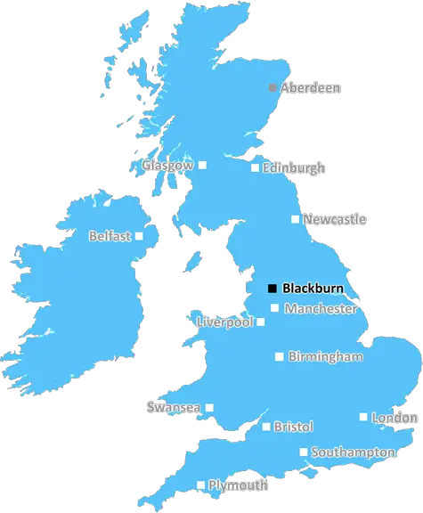
Blackburn (BB12)
The BB12 postcode area is located in the Blackburn postcode town region, within the county of Lancashire, and contains a total of 1176 individual postcodes.
There are 22 electoral wards in the BB12 postcode area, including Accrington, Barnoldswick, Blackburn, Burnley, Clitheroe, Colne, Darwen, Nelson, Rossendale which come under the local authority of the Burnley Council.
Combining the whole postcode region, 17% of people in BB12 are classed as having an AB social grade, (i.e. 'white-collar' middle-upper class), compared to 27% across the UK.
This does not mean that the people of BB12 are poorer than other areas, but it may give an indication that there are areas of deprivation.
The BB12 postcode is a postcode district located in Lancashire, England. It covers parts of the town of Burnley, as well as several other small villages and hamlets throughout the surrounding area.
The postcode district includes the town of Burnley itself, as well as the areas around Bull Hill, Worsthorne, Lane Bottom, Haggate, Brierfield, Reedley, and Fence.
BB12 is an area of mixed industrial, commercial, and residential development, mostly found around the centre of Burnley, and its outskirts. It is home to a few large industrial estates, and a number of small businesses.
The area has a few large schools and nurseries, including Habergham High School, Walshaw Primary School, and Endowed Schools. There is also a hospital at the centre of Burnley.
There are several recreational facilities in and around Burnley, including Thompson Park, Towneley Park, and Queen's Park. There are also many sports venues in the area, such as Turf Moor, the home ground of Burnley FC, and Turf Moor Leisure Centre.
BB12 contains two large retail parks, Central Retail Park, and St Peter's Retail Park. There are also smaller shopping malls around Burnley centre, and several traditional high street stores in the area.
The area is easily accessible by road, with the M65 motorway running through the centre of Burnley, allowing people to travel across Lancashire quickly. The postcode district is also served by the East Lancashire Railway, which stops at a number of stations within Burnley.
Generally, the area is very popular with families due to its good schools, relatively low crime rate, and good accessibility.

Demographics
Lancashire

BB12 is located in the county of Lancashire, in England.
Lancashire has a total population of 1,485,000, making it the 8th largest county in the UK.
Lancashire has a total area of 1187 square miles, and a population density of 482 people per square kilometre. For comparison, Greater London has a density of 5,618 people/km2.
| Outward Code | BB12 |
| Postal Town | Blackburn |
| MSOA Name | Burnley 003 |
| LSOA Name | Burnley 003D |
| County | Lancashire |
| Region | Lancashire |
| Country | England |
| Local Authority | Burnley |
| Area Classification | Urban with City and Town |
BB12 Electoral Wards
The postal region of BB12, includes the local towns, villages, electoral wards and stations of:
Dig even deeper into the BB12 postcode by clicking on a postcode below:
Click on an outward postal code below for more information about the area. Each 'outward' postcode give you a comprehensive list of all postcodes within the outward code area (BB) and estimated address.
Click on an 'outward' code for more information. For example, the outward postcode page 'EC2M' will give you an alphabetical list covering all postcodes located in the region, from 'EC2M 1BB' through to 'EC2M 7YA'.
Chris H
Sunday, April 7, 2024
We don't have any views of BB12 right now. If you live in BB12 or have visited it, please help us to help others by telling others what you think of this neighbourhood.
Add your view of BB12
People need your local expertise. If you live in BB12 or have first-hand knowledge of the neighbourhood, please consider sharing your views. It's completely anonymous - all we ask is for your initials.
Please tell us what you like about the BB12 postcode area, what you don't like, and what it's like to live or work here.
| LOCAL AMENITIES | |
| FAMILY FRIENDLY | |
| PARKING | |
| GREEN SPACES |
Local News Lancashire
Mosque intruder chased off after break-in
Lancashire Police say they are investigating the motive for the break-in at the mosque in Burnley.
BBC NewsBoy held after police officer struck by stolen car
A stolen mobility car was "deliberately driven" at an officer as he approached it, police say.
BBC NewsFamily jailed over multimillion-pound drugs trade
Ian Shacklady, his family and associates supplied large amounts of cocaine and heroin across the UK.
BBC NewsSouthampton stumble goes on with draw at Blackburn
Blackburn Rovers hold Southampton to a goalless draw at Ewood Park as Saints fail to win for the third game in a row.
BBC NewsWatford and Preston play out goalless draw
Watford and Preston play out a relatively drab goalless draw in the Championship.
BBC NewsGhostbusters superfan lands role in latest film
Simon Gray has been collecting toys and merchandise for 30 years.
BBC NewsBlackpool 1-0 Cambridge United
Blackpool keep their faint League One play-off hopes alive with a narrow win over Cambridge at Bloomfield Road.
BBC NewsBritain's loudest birds are booming once again
The RSPB reports ten "booming" males at Leighton Moss - the most on the reserve since the 1990s.
BBC NewsFrom the Postcode Area blog

Deciphering Crime Rates - a Deep Dive Into UK Postcode Analysis
Ever wondered about the crime rate in your UK postcode? You're not alone. We've dug deep into the data, uncovering trends and patterns that'll make your head spin.

Death of the High Street?
The BBC reports that despite councils' attempts to kurb them, the UK's high streets have seen a huge growth in fast food outlets. Could this mark the death knell for the Great British high street, and what can we do about it to halt its decline?

Discrimination by Postcode
You really couldn't make it up, could you? Some of the country's most vulnerable people are missing out on their weekly £25 Cold Weather Payment, just because the system that's in operation is discriminating against them because payments are based on postcode, rather than geographic location.

The Redesign is Underway
Well, the current website was absolutely in dire need of a good redesign - from the ground up. So I set out to pull it all apart and get it up and running again to become the most comprehensive guide to every postcode in the UK. And it's been a long, tough job from start to finish - and quite possibly the biggest project I've ever undertaken.
SOCIAL GRADES
According to census records, 17% of people here have a social grade of AB (highest), compared to the national average of 27%.