coventry CV12 Postcodes
Spending a fortune on conveyancing?

Compare instant, low-cost online quotes from trusted conveyancing solicitors.
Backed by experts, our no-obligation service searches through the best conveyancing quotes on the market to save you time and money.
Coventry (CV12)
The CV12 postcode area is located in the Coventry postcode town region, within the county of Warwickshire, and contains a total of 782 individual postcodes.
There are 19 electoral wards in the CV12 postcode area, including Atherstone, Bedworth, Coventry, Kenilworth, Leamington Spa, Nuneaton, Rugby, Shipston-On-Stour, Southam, Stratford-Upon-Avon, Warwick which come under the local authority of the Nuneaton and Bedworth Council.
Combining the whole postcode region, 15% of people in CV12 are classed as having an AB social grade, (i.e. 'white-collar' middle-upper class), compared to 27% across the UK.
This does not mean that the people of CV12 are poorer than other areas, but it may give an indication that there are areas of deprivation.
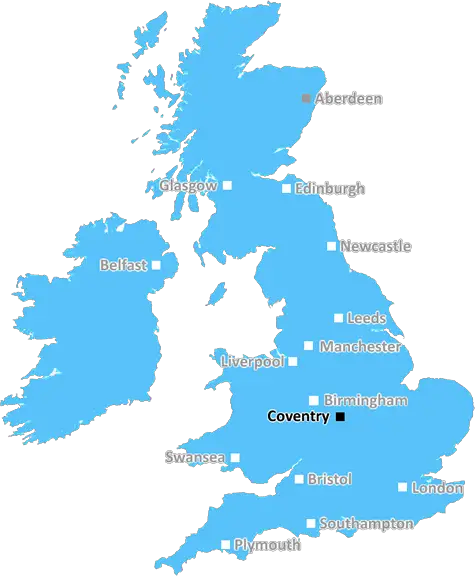
The CV12 postcode is located in the British Midlands, within Coventry and Warwickshire boundary.
It consists of five main areas Avery Hill, Stoke Heath, Binleywood, Willenhall, and Stretton-on-Dunsmore. Each of these areas is now considered part of western Coventry. All five postcode districts have the prefix �CV'.
The postcode is home to an eclectic mix of families, houses, single people, and caters to a wide range of industries. Residential areas in CV12 offer both large detached homes and bungalows with small gardens.
The area is well connected by public transport, Coventry railway station is the closest major station, with local bus services linking passengers to Coventry's main attractions.
For food and socialising, CV12 has a fine selection of local pubs, eateries, and restaurants. Popular destinations include the Pear Tree pub, the Grand Union restaurant, La Frimete, La Isla Bonita, and many more for visitors and locals to enjoy.
CV12 is home to an array of leisure attractions, such as the Coventry Canal, Coventry Sports and Leisure Centre, Abbey Theatre, and Coventry Transport Museum, along with other historic sites and a thriving arts scene.
The area boasts strong schools, including St Osburg's Roman Catholic Primary School, Aspil and Marlborough Primary, and Woodlands Primary School. For higher education, Coventry University, Warwickshire College and South Warwickshire College, are all in close proximity.
Local shops provide convenience to residents and include a variety of supermarkets, vendors, and independent stores. Stoke Heath Shopping Centre is another popular destination for people from the postcode region.
The area is also home to Whitley Common and Allesley Park Country Park, providing plenty of natural beauty to the community and a range of activities for outdoor lovers.
The CV12 postcode is a vibrant, diverse, and unique area of the United Kingdom. Whether it's restaurants, nightlife, leisure facilities, or education and employment options, there is something for everyone in the CV12 postcode.

Demographics
Warwickshire

CV12 is located in the county of Warwickshire, in England.
Warwickshire has a total population of 556,800, making it the 39th largest county in the UK.
Warwickshire has a total area of 763 square miles, and a population density of 281 people per square kilometre. For comparison, Greater London has a density of 5,618 people/km2.
| Outward Code | CV12 |
| Postal Town | Coventry |
| MSOA Name | Nuneaton and Bedworth 012 |
| LSOA Name | Nuneaton and Bedworth 012B |
| County | Warwickshire |
| Region | Warwickshire |
| Country | England |
| Local Authority | Nuneaton and Bedworth |
| Area Classification | Urban with City and Town |
CV12 Electoral Wards
The postal region of CV12, includes the local towns, villages, electoral wards and stations of:
Dig even deeper into the CV12 postcode by clicking on a postcode below:
Click on an outward postal code below for more information about the area. Each 'outward' postcode give you a comprehensive list of all postcodes within the outward code area (CV) and estimated address.
Click on an 'outward' code for more information. For example, the outward postcode page 'EC2M' will give you an alphabetical list covering all postcodes located in the region, from 'EC2M 1BB' through to 'EC2M 7YA'.
Chris H
Monday, April 8, 2024
We don't have any views of CV12 right now. If you live in CV12 or have visited it, please help us to help others by telling others what you think of this neighbourhood.
Add your view of CV12
People need your local expertise. If you live in CV12 or have first-hand knowledge of the neighbourhood, please consider sharing your views. It's completely anonymous - all we ask is for your initials.
Please tell us what you like about the CV12 postcode area, what you don't like, and what it's like to live or work here.
| LOCAL AMENITIES | |
| FAMILY FRIENDLY | |
| PARKING | |
| GREEN SPACES |
Local News Warwickshire
Rat infestations on the rise in Coventry and Warwickshire
A total of 743 infestations were dealt with every day last year.
BBC NewsRadford Road bridge removal
Warwick District Council has received permission from the Environment Agency to proceed with the removal of the existing bridge over the River Leam between Radford Road and Newbold Comyn.
Warwick District CouncilCouncil sets budget for the long-term
At the Council meeting, held on Wednesday 21 February, Councillors approved a range of financial support measures.
Warwick District CouncilPoll Letters issued for Elections in Warwick District
Poll letters notifying residents of Elections taking place in Warwick District on Thursday 2 May 2024 have been sent out in the past couple of weeks.
Warwick District CouncilNew play area for Bishop's Tachbrook
Just in time for Spring, children and families can now enjoy an exciting new play area at Anchitel Green in Bishop's Tachbrook.
Warwick District CouncilLeamington's peregrine falcons lay their first egg
Three live webcams are capturing views of a nesting pair of birds in the town.
BBC NewsKashif's second ton helps Pears build lead over Bears
Kashif Ali hits his second century of the match to help Worcestershire build a potentially match-winning lead over Warwickshire.
BBC NewsYour pictures across the West Midlands
A collection of images submitted by BBC Weather Watchers shows the beauty of the West Midlands.
BBC NewsFrom the Postcode Area blog

Deciphering Crime Rates - a Deep Dive Into UK Postcode Analysis
Ever wondered about the crime rate in your UK postcode? You're not alone. We've dug deep into the data, uncovering trends and patterns that'll make your head spin.

Death of the High Street?
The BBC reports that despite councils' attempts to kurb them, the UK's high streets have seen a huge growth in fast food outlets. Could this mark the death knell for the Great British high street, and what can we do about it to halt its decline?

Discrimination by Postcode
You really couldn't make it up, could you? Some of the country's most vulnerable people are missing out on their weekly £25 Cold Weather Payment, just because the system that's in operation is discriminating against them because payments are based on postcode, rather than geographic location.

The Redesign is Underway
Well, the current website was absolutely in dire need of a good redesign - from the ground up. So I set out to pull it all apart and get it up and running again to become the most comprehensive guide to every postcode in the UK. And it's been a long, tough job from start to finish - and quite possibly the biggest project I've ever undertaken.
SOCIAL GRADES
According to census records, 15% of people here have a social grade of AB (highest), compared to the national average of 27%.