enfield EN5 Postcodes
Spending a fortune on conveyancing?

Compare instant, low-cost online quotes from trusted conveyancing solicitors.
Backed by experts, our no-obligation service searches through the best conveyancing quotes on the market to save you time and money.
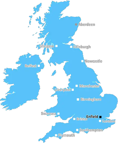
Enfield (EN5)
The EN5 postcode area is located in the Enfield postcode town region, within the county of Greater London, and contains a total of 1684 individual postcodes.
There are 15 electoral wards in the EN5 postcode area, including Barnet, Broxbourne, Enfield, Hoddesdon, Potters Bar, Waltham Abbey, Waltham Cross which come under the local authority of the Barnet Council.
Combining the whole postcode region, 34% of people in EN5 are classed as having an AB social grade, (i.e. 'white-collar' middle-upper class), compared to 27% across the UK.
This does not mean that the people of EN5 are wealthier - or higher class - than average, but it can be an indication that the area may be prospering and desirable to live in.
EN5 is the postcode for the area of Enfield in North London, England. It is predominantly residential and covers a wide area that includes 24 electoral wards, parts of Chase Farm and Trent Park, shopping centres including the Palace Exchange Shopping Centre and surrounding shops, the library, and Enfield Town. Most of the residential postcode is in the London Borough of Enfield but stretches into the Borough of Barnet and the Borough of Hertsmere, covering several villages such as Cockfosters, Freezywater, and Covert Garden.
The area is served by three railway stations, with Enfield Town the main one, located between London's main retail thoroughfare Oxford Street and the outskirts of the city. Enfield Chase and Gordon Hill also serve the area, with bus and tube connections in the boroughs around it.
EN5 postcode has some of London's finest open spaces for leisure and recreation, with gardens and parks throughout. Forty Hall is located to the east of Enfield Town and Trent Park to the south with its woodland walks and public sports activities such as golf and boating. A plethora of independent shops, bars, caf�s and restaurants is located around Enfield Town. The area is also home to several post-secondary schools and colleges, and also has a large North London Muslim Community Centre.
The public sector of Enfield makes a significant contribution to the local economy in the EN5 postcode, with a number of hospital and healthcare centres, leisure facilities, transport services, police, fire and community services. Enfield is popular with commuters due to its close proximity to the city, with Chingford, Edmonton and Cheshunt easily accessed within the EN5 postcode.

Demographics
Greater London

EN5 is located in the county of Greater London, in England.
Greater London has a total population of 8,778,500, making it the 1st largest county in the UK.
Greater London has a total area of 606 square miles, and a population density of 5594 people per square kilometre. For comparison, Greater London has a density of 5,618 people/km2.
| Outward Code | EN5 |
| Postal Town | Enfield |
| MSOA Name | Barnet 005 |
| LSOA Name | Barnet 005A |
| County | Greater London |
| Region | Greater London |
| Country | England |
| Local Authority | Barnet |
| Area Classification | Urban with Major Conurbation |
EN5 Electoral Wards
The postal region of EN5, includes the local towns, villages, electoral wards and stations of:
Dig even deeper into the EN5 postcode by clicking on a postcode below:
Click on an outward postal code below for more information about the area. Each 'outward' postcode give you a comprehensive list of all postcodes within the outward code area (EN) and estimated address.
Click on an 'outward' code for more information. For example, the outward postcode page 'EC2M' will give you an alphabetical list covering all postcodes located in the region, from 'EC2M 1BB' through to 'EC2M 7YA'.
Chris H
Wednesday, May 15, 2024
We don't have any views of EN5 right now. If you live in EN5 or have visited it, please help us to help others by telling others what you think of this neighbourhood.
Add your view of EN5
People need your local expertise. If you live in EN5 or have first-hand knowledge of the neighbourhood, please consider sharing your views. It's completely anonymous - all we ask is for your initials.
Please tell us what you like about the EN5 postcode area, what you don't like, and what it's like to live or work here.
| LOCAL AMENITIES | |
| FAMILY FRIENDLY | |
| PARKING | |
| GREEN SPACES |
Local News Hertfordshire
Coldplay to headline Radio 1's Big Weekend
Becky Hill, Aitch, Sabrina Carpenter and Rudimental will also perform at the three-day festival.
BBC NewsCouncil blames error after women's football 'ban'
Peter McCormack says he will no longer negotiate and the Bedford mayor should resign.
BBC NewsI've had enough' after being punched by a player
Referee Michael Giblin gave up the hobby he loved after the game in Bedford.
BBC NewsWhite elephant sends message on renewed roundabout
Works to improve the roundabout at Clophill, Bedfordshire, took a year to complete.
BBC News'Big Weekend will be huge success for whole town'
The local council estimates the festival can bring 4m to the town's economy.
BBC NewsHow can I get to Radio 1's Big Weekend?
More than 10,000 music fans are expected to attend the sell-out three-day event.
BBC NewsPremier League football club saves top jazz club
Luton Town's property division, 2020 Developments, is buying the home of The Bear Club.
BBC NewsJudo lessons to help 'older adults' combat falls
People will be taught how to fall forward safely without using hands.
BBC NewsFrom the Postcode Area blog

Deciphering Crime Rates - a Deep Dive Into UK Postcode Analysis
Ever wondered about the crime rate in your UK postcode? You're not alone. We've dug deep into the data, uncovering trends and patterns that'll make your head spin.

Death of the High Street?
The BBC reports that despite councils' attempts to kurb them, the UK's high streets have seen a huge growth in fast food outlets. Could this mark the death knell for the Great British high street, and what can we do about it to halt its decline?

Discrimination by Postcode
You really couldn't make it up, could you? Some of the country's most vulnerable people are missing out on their weekly £25 Cold Weather Payment, just because the system that's in operation is discriminating against them because payments are based on postcode, rather than geographic location.

The Redesign is Underway
Well, the current website was absolutely in dire need of a good redesign - from the ground up. So I set out to pull it all apart and get it up and running again to become the most comprehensive guide to every postcode in the UK. And it's been a long, tough job from start to finish - and quite possibly the biggest project I've ever undertaken.
SOCIAL GRADES
According to census records, 34% of people here have a social grade of AB (highest), compared to the national average of 27%.