derby DE55 Postcodes
Spending a fortune on conveyancing?

Compare instant, low-cost online quotes from trusted conveyancing solicitors.
Backed by experts, our no-obligation service searches through the best conveyancing quotes on the market to save you time and money.
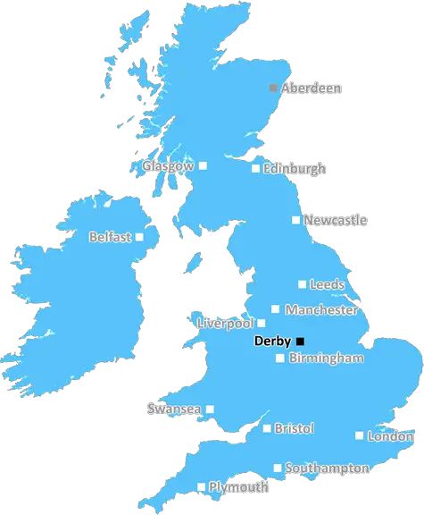
Derby (DE55)
The DE55 postcode area is located in the Derby postcode town region, within the county of Derbyshire, and contains a total of 1402 individual postcodes.
There are 68 electoral wards in the DE55 postcode area, including Alfreton, Ashbourne, Bakewell, Belper, Burton-On-Trent, Derby, Heanor, Ilkeston, Matlock, Ripley, Swadlincote which come under the local authority of the Amber Valley Council.
Combining the whole postcode region, 15% of people in DE55 are classed as having an AB social grade, (i.e. 'white-collar' middle-upper class), compared to 27% across the UK.
This does not mean that the people of DE55 are poorer than other areas, but it may give an indication that there are areas of deprivation.
The DE55 postcode is located in the Bolsover district of Derbyshire, England. It covers an area which runs from Pilsbury and Stretton to Tibshelf, Hardstoft, Murray Hill, Temple Normanton and Duckmanton and their surrounding villages.
The DE55 postcode covers a large area and its population of over 10,000 is located largely in three towns and five villages. It is a largely rural area, composed mainly of agricultural land with some commercial and industrial features, including Tibshelf Services, the country's first motorway services on the M1, located near junction 28.
The area's villages offer a range of amenities from pubs and shop, to churches of the Church of England and Methodist faiths and several independent schools. The landscape also provides plenty of outdoor recreation and offers a range of walks and cycling routes, such as the Five Pits Trail and the John Socs Emergency Trail. Other local attractions include the Pilsbury Castle, LeaWood Garden Centre and Recreation Ground, and Hardstoft reservoir.
There are several local bus services available in the area, including services to nearby Alfreton, Chesterfield, Nottingham, and Sheffield as well as the Robin Hood line. Local residents have access to good rail links, with regular services to both Chesterfield and Nottingham.
The Domiciliary Care Agency of Derbyshire (DCAD) is the district's provider of adult social care services, with a preference to provide domiciliary care to those living in or near to their own homes, wherever possible. The area has a number of doctors' practices, including those at Hardstoft, Stretton and Tibshelf, as well as a number of dental practices, opticians and pharmacies.
The area is served by Bolsover District Council, which is responsible for the provision of local government services. The council covers an area of more than 80 square miles and is made up of 13 towns and villages, including the DE55 postcode area. The council's priorities are to create a vibrant and sustainable economy, ensure effective services across all sectors, ensure that all residents have access to good quality education and support, and involve and engage with local residents.

Demographics

Derbyshire

DE55 is located in the county of Derbyshire, in England.
Derbyshire has a total population of 1,042,000, making it the 20th largest county in the UK.
Derbyshire has a total area of 1013 square miles, and a population density of 396 people per square kilometre. For comparison, Greater London has a density of 5,618 people/km2.
| Outward Code | DE55 |
| Postal Town | Derby |
| MSOA Name | Amber Valley 004 |
| LSOA Name | Amber Valley 004E |
| County | Derbyshire |
| Region | Derbyshire |
| Country | England |
| Local Authority | Amber Valley |
| Area Classification | Urban with Minor Conurbation |
DE55 Electoral Wards
The postal region of DE55, includes the local towns, villages, electoral wards and stations of:
Dig even deeper into the DE55 postcode by clicking on a postcode below:
Click on an outward postal code below for more information about the area. Each 'outward' postcode give you a comprehensive list of all postcodes within the outward code area (DE) and estimated address.
Click on an 'outward' code for more information. For example, the outward postcode page 'EC2M' will give you an alphabetical list covering all postcodes located in the region, from 'EC2M 1BB' through to 'EC2M 7YA'.
Chris H
Sunday, April 7, 2024
We don't have any views of DE55 right now. If you live in DE55 or have visited it, please help us to help others by telling others what you think of this neighbourhood.
Add your view of DE55
People need your local expertise. If you live in DE55 or have first-hand knowledge of the neighbourhood, please consider sharing your views. It's completely anonymous - all we ask is for your initials.
Please tell us what you like about the DE55 postcode area, what you don't like, and what it's like to live or work here.
| LOCAL AMENITIES | |
| FAMILY FRIENDLY | |
| PARKING | |
| GREEN SPACES |
Local News Derbyshire
Police launch appeal after serious assault in Derby
Police would like to speak to two men in connection with the incident
Derby TelegraphDerbyshire mum recalls the 'scary time' her newborn baby was diagnosed with rare condition
Luca required urgent care after he was born in Chesterfield
Derby TelegraphChip shop opened in World War Two to close
Owner Gary Tennant says he wants to retire but will "miss it so much".
BBC NewsDay centres facing closure under council shake-up
Four centres supporting people who are autistic or have learning disabilities could be closed.
BBC NewsDerby's Guildhall in line for 24m restoration
The Grade II listed building was at risk of falling into disrepair, the council said.
BBC NewsDeveloper fights back in plan to transform unsightly old Peak District hotel site
The Marquis of Granby was once a grand hotel but went out of business in 2004
Derby TelegraphBurton Albion 0-4 Oxford United
Mark Harris' double helps push Oxford back into the League One play-off places as they ruthlessly beat Burton.
BBC NewsPicture-perfect Peak District village dark past brought back to life
The village became famous after the Black Death
Derby TelegraphFrom the Postcode Area blog

Deciphering Crime Rates - a Deep Dive Into UK Postcode Analysis
Ever wondered about the crime rate in your UK postcode? You're not alone. We've dug deep into the data, uncovering trends and patterns that'll make your head spin.

Death of the High Street?
The BBC reports that despite councils' attempts to kurb them, the UK's high streets have seen a huge growth in fast food outlets. Could this mark the death knell for the Great British high street, and what can we do about it to halt its decline?

Discrimination by Postcode
You really couldn't make it up, could you? Some of the country's most vulnerable people are missing out on their weekly £25 Cold Weather Payment, just because the system that's in operation is discriminating against them because payments are based on postcode, rather than geographic location.

The Redesign is Underway
Well, the current website was absolutely in dire need of a good redesign - from the ground up. So I set out to pull it all apart and get it up and running again to become the most comprehensive guide to every postcode in the UK. And it's been a long, tough job from start to finish - and quite possibly the biggest project I've ever undertaken.
SOCIAL GRADES
According to census records, 15% of people here have a social grade of AB (highest), compared to the national average of 27%.