shrewsbury SY23 Postcodes
Spending a fortune on conveyancing?

Compare instant, low-cost online quotes from trusted conveyancing solicitors.
Backed by experts, our no-obligation service searches through the best conveyancing quotes on the market to save you time and money.
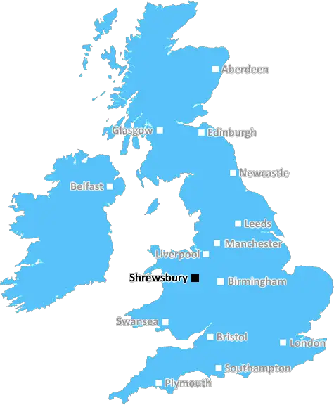
Shrewsbury (SY23)
The SY23 postcode area is located in the Shrewsbury postcode town region, within the county of Ceredigion, and contains a total of 1213 individual postcodes.
There are 98 electoral wards in the SY23 postcode area, including Aberystwyth, Bishops Castle, Borth, Bow Street, Bucknell, Caersws, Church Stretton, Craven Arms, Ellesmere, Llanbrynmair, Llandinam, Llanfechain, Llanfyllin, Llanidloes, Llanon, Llanrhystud, Llansantffraid, Llanymynech, Ludlow, Lydbury North, Machynlleth, Malpas, Meifod, Montgomery, Newtown, Oswestry, Shrewsbury, Talybont, Tregaron, Welshpool, Whitchurch, Ystrad Meurig which come under the local authority of the Ceredigion Council.
Combining the whole postcode region, 21% of people in SY23 are classed as having an AB social grade, (i.e. 'white-collar' middle-upper class), compared to 27% across the UK.
This does not mean that the people of SY23 are poorer than other areas, but it may give an indication that there are areas of deprivation.
The SY23 postcode in the UK is a postcode district that covers the area around Aberystwyth in Ceredigion, Mid Wales. It is part of the SY postcode area, which also includes parts of South West Wales including Cardiganshire, Pembrokeshire, Carmarthenshire and Swansea. The SY23 area includes the town of Aberystwyth itself, the villages of Albano, Bow Street, Llanbadarn Fawr, Capel Dewi, and other rural communities including the settlements at Aberffrwd and Garras.
The postcode district serves a population of about 11,000 people. Historically, the local economy has been primarily agricultural, but in modern times tourism and other service industries such as education, hospitality and retail have become increasingly important.
The SY23 area is home to the University of Aberystwyth, two hospitals, several historic sites, and a number of theatres. The coastline and beaches are popular with tourists, and the area is known for its surfing and water sports. Aberystwyth is also known for its picturesque harbour, with its Victorian promenade, and Castle Point with views over the sea.
The area is served by an extensive bus network, including services to nearby towns and cities such as Carmarthen, Shrewsbury and Birmingham. It is also served by Aberystwyth railway station on the Cambrian Line, which runs through the district and provides regular services to such places as Machynlleth, Pwllheli, Shrewsbury and Birmingham.
The main shopping area is in the town of Aberystwyth itself, which also has a wide range of restaurants, bars, and other amenities. Other local centres include Bow Street, Capel Dewi, and Taliesin. The area is also home to a number of festivals and events, including the Aberystwyth Arts Centre Festival and the Aberystwyth Food Festival.
Local sports clubs include Aberystwyth Town FC, Aberystwyth Golf Club, Aberystwyth Baseball and Softball Club, and Aberystwyth Rowing Club. The area has its own county cricket club, as well as a number of athletics and rugby clubs.
Aberystwyth and the surrounding area of SY23 are surrounded by a stunning natural landscape with hills such as Plynlimon to the south and the Cambrian Mountains to the north. The area also has four National Nature Reserves, including Cors Fochno, Ynys-hir and the Dyfi Estuary.
The SY23 postcode serves a stunning and diverse area filled with natural beauty, excellent amenities and a strong sense of community. It is an area that welcomes tourists and has plenty to offer all year round.

Demographics
Ceredigion

SY23 is located in the county of Ceredigion, in Wales.
Ceredigion has a total population of 74,100, making it the 19th largest county in the UK.
Ceredigion has a total area of 688 square miles, and a population density of 41 people per square kilometre. For comparison, Greater London has a density of 5,618 people/km2.
| Outward Code | SY23 |
| Postal Town | Shrewsbury |
| MSOA Name | Ceredigion 002 |
| LSOA Name | Ceredigion 002B |
| County | Ceredigion |
| Region | Ceredigion |
| Country | Wales |
| Local Authority | Ceredigion |
| Area Classification | Unclassified |
SY23 Electoral Wards
The postal region of SY23, includes the local towns, villages, electoral wards and stations of:
Dig even deeper into the SY23 postcode by clicking on a postcode below:
Click on an outward postal code below for more information about the area. Each 'outward' postcode give you a comprehensive list of all postcodes within the outward code area (SY) and estimated address.
Click on an 'outward' code for more information. For example, the outward postcode page 'EC2M' will give you an alphabetical list covering all postcodes located in the region, from 'EC2M 1BB' through to 'EC2M 7YA'.
Chris H
Monday, April 8, 2024
We don't have any views of SY23 right now. If you live in SY23 or have visited it, please help us to help others by telling others what you think of this neighbourhood.
Add your view of SY23
People need your local expertise. If you live in SY23 or have first-hand knowledge of the neighbourhood, please consider sharing your views. It's completely anonymous - all we ask is for your initials.
Please tell us what you like about the SY23 postcode area, what you don't like, and what it's like to live or work here.
| LOCAL AMENITIES | |
| FAMILY FRIENDLY | |
| PARKING | |
| GREEN SPACES |
From the Postcode Area blog

Deciphering Crime Rates - a Deep Dive Into UK Postcode Analysis
Ever wondered about the crime rate in your UK postcode? You're not alone. We've dug deep into the data, uncovering trends and patterns that'll make your head spin.

Death of the High Street?
The BBC reports that despite councils' attempts to kurb them, the UK's high streets have seen a huge growth in fast food outlets. Could this mark the death knell for the Great British high street, and what can we do about it to halt its decline?

Discrimination by Postcode
You really couldn't make it up, could you? Some of the country's most vulnerable people are missing out on their weekly £25 Cold Weather Payment, just because the system that's in operation is discriminating against them because payments are based on postcode, rather than geographic location.

The Redesign is Underway
Well, the current website was absolutely in dire need of a good redesign - from the ground up. So I set out to pull it all apart and get it up and running again to become the most comprehensive guide to every postcode in the UK. And it's been a long, tough job from start to finish - and quite possibly the biggest project I've ever undertaken.
SOCIAL GRADES
According to census records, 21% of people here have a social grade of AB (highest), compared to the national average of 27%.