aberdeen AB22 Postcodes
Spending a fortune on conveyancing?

Compare instant, low-cost online quotes from trusted conveyancing solicitors.
Backed by experts, our no-obligation service searches through the best conveyancing quotes on the market to save you time and money.
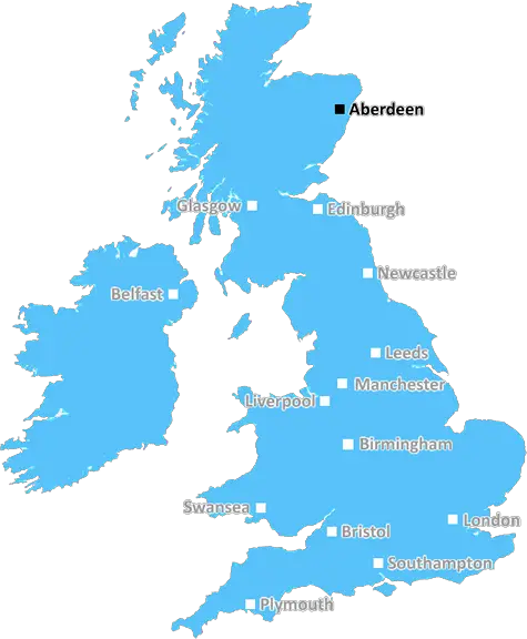
Aberdeen (AB22)
The AB22 postcode area is located in the Aberdeen postcode town region, within the county of Aberdeenshire, and contains a total of 359 individual postcodes.
There are 3 electoral wards in the AB22 postcode area, including Aberdeen, Aberlour, Aboyne, Alford, Ballater, Ballindalloch, Banchory, Banff, Buckie, Ellon, Fraserburgh, Huntly, Insch, Inverurie, Keith, Laurencekirk, Macduff, Milltimber, Peterculter, Peterhead, Stonehaven, Strathdon, Turriff, Westhill which come under the local authority of the Aberdeen City Council.
Combining the whole postcode region, 0% of people in AB22 are classed as having an AB social grade, (i.e. 'white-collar' middle-upper class), compared to 27% across the UK.
This does not mean that the people of AB22 are poorer than other areas, but it may give an indication that there are areas of deprivation.
AB22 postcode is located in the City of Aberdeen District in Scotland, UK. It covers most of the northern part of the district, including the towns and villages of Bridge of Don, Bucksburn, Danestone, Dyce, Kincorth, Milltimber, and Nigg.
AB22 postcode is bordered by the postcodes AB21 in the north, AB12 to the east, AB15 to the south, and AB23 to the west. The area has excellent transport links to the rest of the city and to neighbouring areas, including a nearby airport, train station and good bus networks.
The area is home to many tourist attractions, including historic castles, beautiful countryside, and sandy beaches. There are numerous art galleries and museums, as well as plenty of local bars, restaurants and caf�s. Shopping is available in the nearby Bridge of Don Shopping Centre and Aberdeen city centre.
The AB22 postcode is known for its excellent education resources. It is home to 16 Primary Schools, four Secondary Schools, and two primary and secondary specialist schools. There are numerous University campuses in the area, including Robert Gordon University, Aberdeen College, and University of Aberdeen. There are also several further education establishments, such as Aberdeen College, Gordonstoun, and North East Scotland College.
The area has plenty of leisure facilities, including sport centres, golf courses, and amenities. There are numerous parks, which provide great areas for walking, as well as play parks for children. Churches of many denominations are also found in the AB22 postcode area.
In terms of health services, the area has two hospitals and several GP surgeries. There are also several dentists, optometrists, and pharmacists. The area also has numerous community groups and activities, including support and charitable groups.
TheAB22 postcode area can be considered a great place to live and work in. With excellent transport links, great educational resources, and plenty of leisure activities, this area is a fantastic place to call home.

Demographics
Aberdeenshire

AB22 is located in the county of Aberdeenshire, in Scotland.
Aberdeenshire has a total population of 0, making it the largest county in the UK.
Aberdeenshire has a total area of square miles, and a population density of people per square kilometre. For comparison, Greater London has a density of 5,618 people/km2.
| Outward Code | AB22 |
| Postal Town | Aberdeen |
| MSOA Name | Danestone |
| LSOA Name | |
| County | Aberdeenshire |
| Region | Aberdeenshire |
| Country | Scotland |
| Local Authority | Aberdeen City |
| Area Classification | Unclassified |
AB22 Electoral Wards
The postal region of AB22, includes the local towns, villages, electoral wards and stations of:
Dig even deeper into the AB22 postcode by clicking on a postcode below:
Click on an outward postal code below for more information about the area. Each 'outward' postcode give you a comprehensive list of all postcodes within the outward code area (AB) and estimated address.
Click on an 'outward' code for more information. For example, the outward postcode page 'EC2M' will give you an alphabetical list covering all postcodes located in the region, from 'EC2M 1BB' through to 'EC2M 7YA'.
Chris H
Monday, April 8, 2024
We don't have any views of AB22 right now. If you live in AB22 or have visited it, please help us to help others by telling others what you think of this neighbourhood.
Add your view of AB22
People need your local expertise. If you live in AB22 or have first-hand knowledge of the neighbourhood, please consider sharing your views. It's completely anonymous - all we ask is for your initials.
Please tell us what you like about the AB22 postcode area, what you don't like, and what it's like to live or work here.
| LOCAL AMENITIES | |
| FAMILY FRIENDLY | |
| PARKING | |
| GREEN SPACES |
From the Postcode Area blog

Deciphering Crime Rates - a Deep Dive Into UK Postcode Analysis
Ever wondered about the crime rate in your UK postcode? You're not alone. We've dug deep into the data, uncovering trends and patterns that'll make your head spin.

Death of the High Street?
The BBC reports that despite councils' attempts to kurb them, the UK's high streets have seen a huge growth in fast food outlets. Could this mark the death knell for the Great British high street, and what can we do about it to halt its decline?

Discrimination by Postcode
You really couldn't make it up, could you? Some of the country's most vulnerable people are missing out on their weekly £25 Cold Weather Payment, just because the system that's in operation is discriminating against them because payments are based on postcode, rather than geographic location.

The Redesign is Underway
Well, the current website was absolutely in dire need of a good redesign - from the ground up. So I set out to pull it all apart and get it up and running again to become the most comprehensive guide to every postcode in the UK. And it's been a long, tough job from start to finish - and quite possibly the biggest project I've ever undertaken.
SOCIAL GRADES
According to census records, 0% of people here have a social grade of AB (highest), compared to the national average of 27%.